
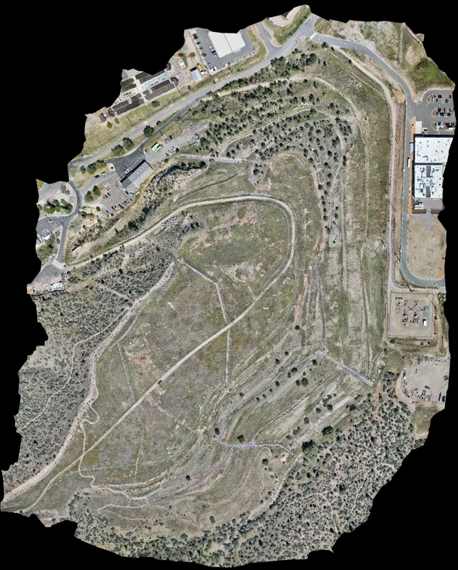
Maps assembled from aerial photographs
Photogrammetry combines overlapping photographs into outputs such as orthomosaics and three-dimensional models. An orthomosaic brings many aerial images together into a continuous overhead view, making it easier to understand the relationship between site features.
Useful for property and project teams
- Documenting existing site conditions.
- Reviewing buildings, access routes, storage areas, and open land.
- Sharing construction progress with people who cannot visit the site.
- Adding visual context to inventory review and project planning.
Define the deliverable before capture
Discuss the area to cover, the detail you need to see, and how the output will be opened or shared. Depending on the agreed scope, deliverables can include aerial photographs, an orthomosaic, or a 3D model. File formats, viewing options, and any measurement requirements should be agreed before work begins.
Example: a 40-acre retired landfill
The DANCIND gallery includes an orthomosaic of approximately 40 acres of a retired landfill in Prescott, Arizona. It presents the site layout in a single view for visual documentation. The example does not establish survey accuracy or a verified volume measurement.
Explore the landfill image at full resolution →
Accuracy and intended use
Tell Brendan at the outset if you need measurements, a particular coordinate system, or a specified accuracy. Image detail alone does not establish positional accuracy. Mapping and measurements require independent verification before use for surveying, engineering, or other decisions that depend on verified accuracy.
Planning and pricing
The area, terrain, access, capture detail, travel, output formats, and processing requirements affect the quote. Share a location and a description of the intended use so the work can be scoped appropriately.